Google Maps: Find a Hotel on Your Route

Oh! Lost on the way. Now in this case there is no need to fret. No need to ask anyone for directions. The only thing you must have is access to the internet. You can get directions to any destination by Google maps. The most easy and convenient way to find the way out.
Google map is very propitious for finding directions from one place to another. To access it just go to Google and click on maps at the top. Just mention the place you are at and the place you need to reach. You will get the way easily.
If you want to find a hotel on your way just mention the name of the places in your way and word hotel on the left side of the screen. By default Google maps will show you two place to mention A and B. On clicking on add destination you can get the third option C. Enter your current location in A and destination in C along with the word “hotels” in B. So it will show you the way with the blue color line between A and C going from hotel indicated as B. You can get the route to go by car, public transport, walking and bicycling. There are options for these four modes just above A.
It calculates the time in which you would reach to the place in each mode of transport. In case of public transport it will first give you the direction to reach the place from which you could get the public transport and then the route to your destination. In case of by car option it also shows the cost of fuel you need to reach your destination. It also gives turn-by-turn guidance.
Suppose you are at Lord’s Cricket Ground and you want to reach Tottenham Court. You want to have lunch in between at a hotel and then hit the road.
So just go to Google maps and type Lord’s Cricket Ground in A hotel in B and Great Portland Street in C. You will get the path for all the 4 modes of transport along with the direction.
It will give you the following data along with the directions:
By Car
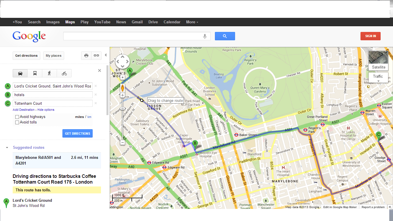
Total time 11 minutes. Time from Lord’s Cricket Ground to the hotel is 2 minutes and at a distance of 0.7 miles and from hotel to Tottenham Court 8 minutes at a distance of 1.2 miles and the fuel will cost you £0.65.
By Public Transport

It will only the distance between the two places. So you can’t find the route on your way by public transport. It tells you to walk to St. John’s Wood Rd (Stop H). Take the 189 Bus towards Soho. Stop at Baker’s Street (Stop D). From there take bus 18 towards Euston. Stop at Warren Street (Stop KA). Walk to Tottenham Court Road. Travel time of about 24 Minutes.
Walking
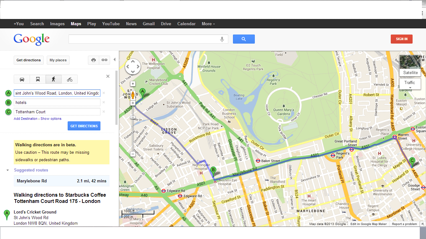
Total time 42 minutes and at a distance of 2.1 miles. From Lord’s Cricket Ground to hotel 14 minutes and at a distance of 0.7 miles. Then from hotel to Tottenham Court 28 minutes at a distance of 1.3 miles.
Bicycling

Total time 15 minutes at a distance of 2.6 miles. From Lord’s Cricket Ground to hotel 4 minutes and at a distance of 0.7 miles. Then from hotel to Tottenham Court 12 minutes at a distance of 1.9 miles
So with Google maps by your side, you’ll always make it to wherever you want to go.


ReplyDeleteIndependence day songs download
Independence day songs download latest
Independence day songs download new
Independence day songs download online
Independence day songs download movies
Independence day songs download online movies
Independence day live speech download
Independence day hot songs download
Independence day live speech download
Independence day youtube songs download
Independence day songs download whatsapp
Independence day songs download facebook